
Manatee County ZIP Coverage Areas
The official county parcel service exposes property ZIP and property city as separate fields. Distinct values found there on August 21, 2026, form the coverage list below. It describes parcels in the county dataset, not every USPS PO-box or unique code. Postal stations are not reliably named in the research, so the third column states the postal city labels found with each code rather than inventing station names.
| ZIP | Areas covered | Postal city labels | Boundary note |
|---|---|---|---|
| 34201 | Eastern and southern edge | Bradenton, Palmetto, University Park | Labels cross civic lines |
| 34202 | Lakewood Ranch and east county | Bradenton, Lakewood Ranch | Mostly outside City of Bradenton |
| 34203 | Southeast Bradenton area | Bradenton | City and county contexts |
| 34205 | Central Bradenton | Bradenton, one Ellenton anomaly | Verify anomalous parcel |
| 34207, 34208, 34209 | South, east, and west Bradenton areas | Bradenton | Mail label is not a city line |
| 34210, 34215 | Southwest mainland and Cortez | Bradenton, Cortez | Verify coastal addresses |
| 34211, 34212 | Lakewood Ranch, northeast and east county | Bradenton, Lakewood Ranch, Parrish | Several community labels |
| 34216 | North Anna Maria Island | Anna Maria | Island municipality |
| 34217, 34218 | Central and south Anna Maria Island | Bradenton Beach, Holmes Beach | Verify current 34218 status |
| 34219 | Broad north and rural east county | Bradenton, Duette, Myakka City, Palmetto, Parrish | Wide label mix |
| 34221, 34222 | North of Manatee River, Terra Ceia, Ellenton | Palmetto, Parrish, Terra Ceia, Ellenton | Multiple local areas |
| 34228 | Longboat Key | Longboat Key | Municipality spans two counties |
| 34240, 34243 | Southeastern and southern edge | Bradenton, Sarasota | Strong postal and civic mismatch |
| 34251 | Rural east and southeast | Myakka City | Large rural area |
| 33598, 34266 | Northern edge and isolated parcel label | Wimauma, Sidell | Address-level verification required |
The parcel data also produced a malformed value, S119. It is not published as a ZIP. That error is a useful warning: bulk GIS data can narrow research, but only address-level postal verification settles a delivery code.
Map Manatee ZIP Directory Layers
The Manatee County GIS open-data catalog lists parcels, municipalities, address points, ZIPs, subdivisions, cities, 911 municipalities, road centerlines, fire zones, sheriff zones, and the county boundary. Those layers let a reader see which geographic systems overlap instead of treating the text after a street address as a legal border.
The open parcel schema is especially useful because it keeps the property's ZIP, the owner's mailing ZIP, and the property city in different fields. It also supplies parcel ID, owner, primary address, subdivision, lot and block, zoning, sale data, values, census geography, and latitude and longitude.
The county publishes the underlying parcel feature schema for review.
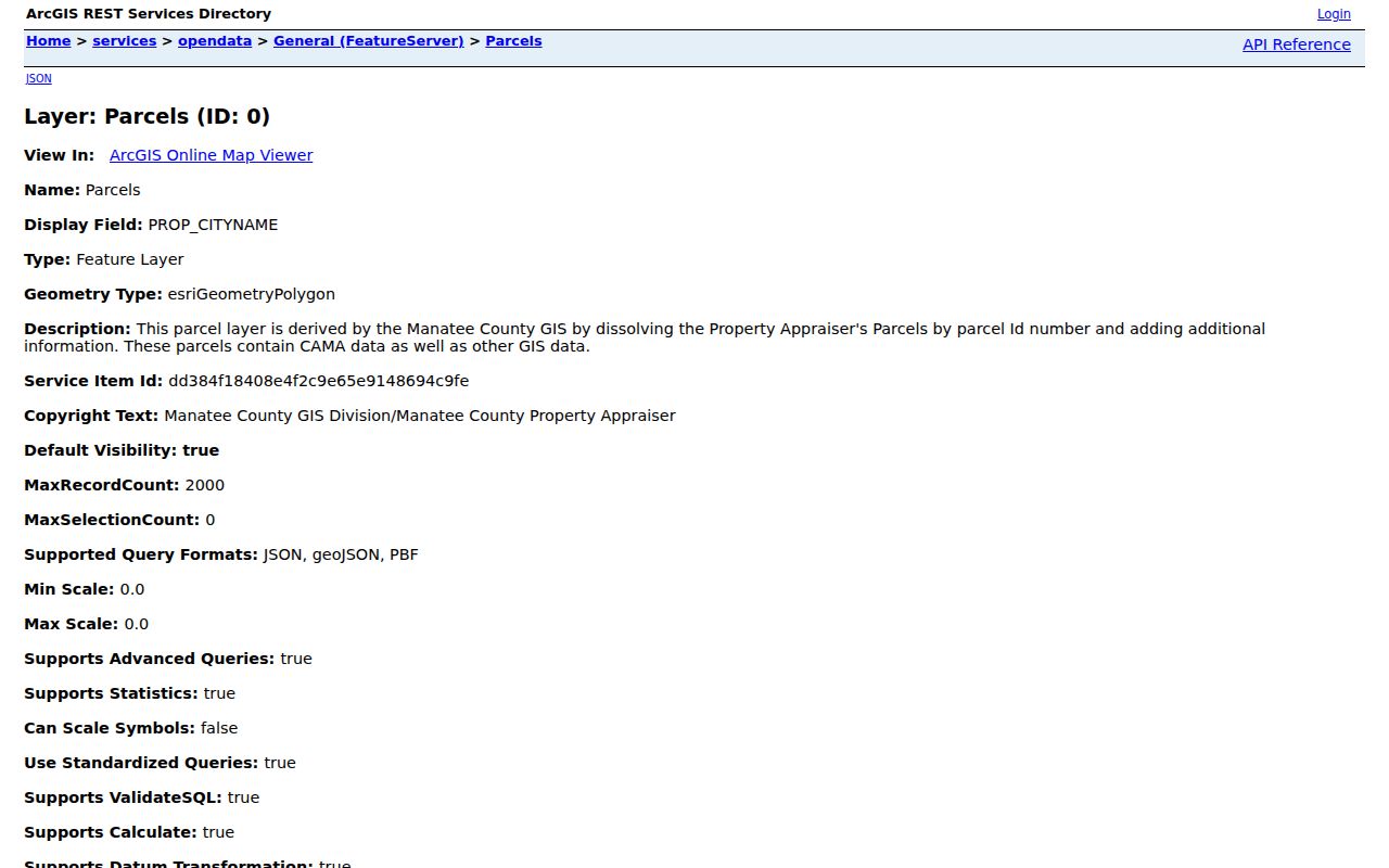
The schema makes the distinction visible: PROP_ZIP describes the parcel, while OWN_ZIP is where the owner's mail goes.
The broader GIS service shows the county's available reference layers.
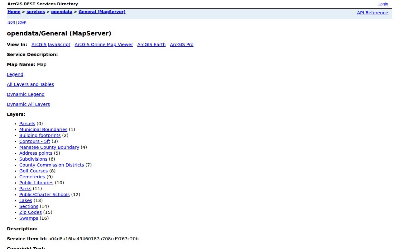
Use municipality and county-boundary layers beside ZIP geometry when the government office responsible for an address matters.
Bradenton ZIP Labels Cross Boundaries
A Bradenton postal city does not prove that a parcel lies inside the City of Bradenton. The county data pairs Bradenton with Lakewood Ranch, Cortez, Parrish, and edge areas that sit in unincorporated Manatee County or another civic context. University Park and Lakewood Ranch are community and postal names, not one incorporated city boundary.
This matters for record requests. County Development Services may keep one address record, while the City of Bradenton public records office keeps another. Check the parcel and municipal layer before choosing a custodian.
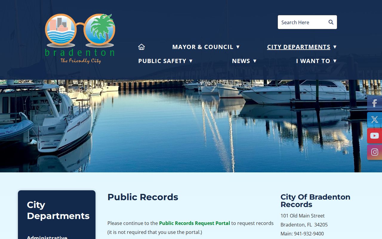
The city request page is the right channel only after GIS confirms that the address falls within Bradenton's jurisdiction.
Note: A familiar postal city is a mail-routing label, not evidence that city government holds the requested address record.
Island ZIP Geography in Manatee County
Anna Maria Island demonstrates why a ZIP code directory needs municipal context. Code 34216 aligns with Anna Maria, while 34217 carries Bradenton Beach and Holmes Beach labels. Code 34218 appears in parcel data for Holmes Beach, but its current status should be checked at the address level. One island can therefore require both a postal check and a municipal check before a permit or local record request is sent.
Longboat Key adds a county boundary. ZIP 34228 and the municipality extend through both Manatee and Sarasota counties. A Longboat Key mailing address alone does not decide which county's parcel, deed, court, or tax source applies. Plot the parcel against the county line, then use the custodian on that side.
Boundary check. On a coastal or island address, compare USPS delivery, county parcel, municipality, and county boundary before searching a resident name.
Rural Manatee ZIP Directory Anomalies
Rural east and north Manatee County produce the widest label mixtures. The parcel layer associates 34219 with Bradenton, Duette, Myakka City, Palmetto, and Parrish. Code 34251 centers on Myakka City. Codes 33598 with Wimauma and 34266 with Sidell appear as boundary or isolated anomalies, so neither should be generalized from one parcel.
Large rural codes cover much more ground than a compact neighborhood. Subdivision names, section-township-range references, and legal descriptions may identify land more reliably than a postal place name. A legal description can survive after postal wording or street numbering changes.
No authoritative source in the research documents a dated countywide ZIP split or a complete street-renumbering chronology. Do not infer one. For old addresses, match the legal description, parcel, plat, cross streets, and historic maps rather than forcing modern ZIP geography onto an earlier record.
Find Records Within a Manatee ZIP
No official local portal is a ZIP resident search. The parcel service can filter property ZIP and return owners and parcels, subject to a 2,000-record maximum with pagination. That makes it an owner and property dataset. It does not list renters, household members, or everyone receiving mail.
- Verify a complete deliverable address in the USPS ZIP Code Lookup.
- Open the county GIS and compare the parcel, ZIP, municipality, address point, and county boundary.
- Filter the parcel layer on PROP_ZIP when an owner/property set is the actual goal, and paginate if the result exceeds 2,000 records.
- Compare PROP_ZIP with OWN_ZIP. A difference means the tax mail goes elsewhere, not that an occupant moved.
- Once a parcel or street is known, use the Manatee County by-street directory for address-level property, deed, plat, and permit steps.
The USPS tool is the authoritative source for a particular delivery address.
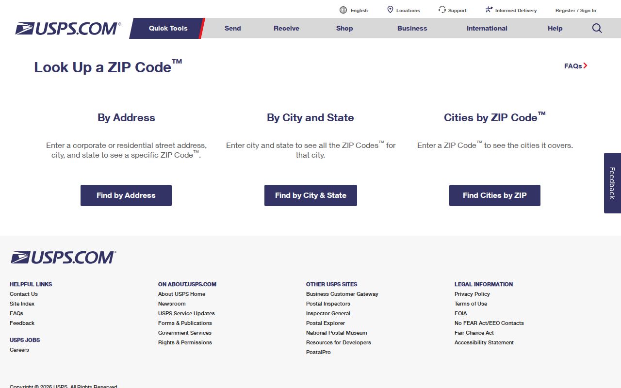
Enter the whole address. A city-and-state lookup is useful for possibilities, but it cannot resolve parcel jurisdiction.
Manatee ZIP Search Fields Explained
The county data separates fields that look similar in ordinary mailing use. Choosing the wrong one can place an owner in the same ZIP as a parcel when the owner actually receives tax mail elsewhere.
| Field or control | Meaning | Safe use |
|---|---|---|
| PROP_ZIP | ZIP attached to the property address | Filter parcels within a postal area |
| OWN_ZIP | ZIP in the owner's mailing address | Identify tax-mail destination only |
| PROP_CITYNAME | Property city or community label | Compare with, but do not replace, municipal boundaries |
| Parcel ID | County property identifier | Pivot to assessment and deed research |
| ZIP layer | Mapped ZIP geometry | See overlap with parcels and civic lines |
| Address points | Mapped site locations | Check house, unit, direction, name, and suffix |
The Property Locator also supports address or parcel autocomplete, parcel-layer search, By Shape, By Value, and By Spatial modes, selection tolerance, and buffers measured in feet. For this task, ZIP and municipality layers provide context; they do not turn mapped owners into a list of residents.
Manatee ZIP Boundaries and City Limits
USPS designs ZIPs for delivery. Manatee County and its municipalities draw boundaries for government. Census ZIP Code Tabulation Areas, or ZCTAs, approximate ZIP geography for statistics. These three systems answer different questions and can disagree without any source being defective.
- ZIP code
- A USPS routing code for mail delivery, not a city or county boundary.
- ZIP+4
- A more precise delivery segment added to the five-digit ZIP for an address or group.
- PO-box ZIP
- A code used for post-office boxes rather than ordinary street delivery.
- Unique ZIP
- A code assigned to one large organization or delivery recipient.
- Carrier route
- A group of delivery points served along one postal route.
- ZCTA
- A Census Bureau statistical area built to resemble ZIP distribution.
A Manatee County ZIP code directory can narrow a search, but parcel GIS establishes county and municipal context, and USPS settles delivery. The county's E911, Development, or GIS staff is the proper source for address assignment or readdressing questions.
What Manatee ZIP Codes Cannot Prove
A ZIP cannot prove that a person lives at an address. Property records name owners, not full households. Owner mailing fields may point to another county or state. Voter records have protected fields and the public web form authenticates an individual's own status with name, birth date, and other prompts; it is not a tool for browsing everyone in a code.
Postal codes also cannot identify the right public office by themselves. A Sarasota label can still occur on a southern Manatee parcel, and Longboat Key reaches Sarasota County. Start with the parcel and civic boundary before filing a request. For a known, nonexempt county record that is not online, Florida Public Records Law allows a focused request, but the office need not create a ZIP resident directory.
Use names and addresses for lawful personal research only. Protected addresses and confidential records remain protected even when the surrounding ZIP is known. Never use parcel or postal data to stalk, harass, threaten, or harm a person.